Geological Park of Costa Quebrada
There are places where a breathtaking landscape hides deeper meanings. The Costa Quebrada Geopark is one of those exceptional natural jewels, having been included in the UNESCO Global Geoparks Network. The geopark has been declared one of the most relevant geological sites in the world, thanks to the coastal stretch between Punta de Los Pilis and the Miengo marsh being declared a Spanish Global Geosite by the International Union of Geological Sciences (IUGS).
Geology is undoubtedly for everyone here
The territory of the Costa Quebrada Geopark spans a total area of 345 km2, of which 270 km2 correspond to land areas and the remaining 75 km2 to the surrounding marine areas, constituting a perfectly defined and homogeneous territorial unit from a geological, geographical, historical, environmental, and landscape perspective.
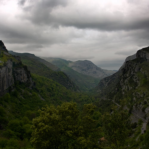
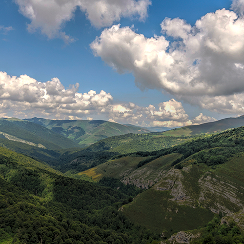
The Costa Quebrada Geopark extends across a total of eight municipalities: Santander, Santa Cruz de Bezana, Piélagos, Miengo, Suances, Santillana del Mar, Polanco, and Camargo. All of them lie within a folded structure of the San Román-Santillana Syncline, which affects Upper Cretaceous and Paleogene materials. This folded structure offers a great variety of formations that illustrate centuries of geological history.
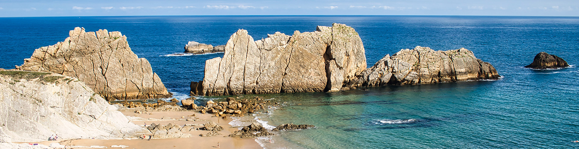
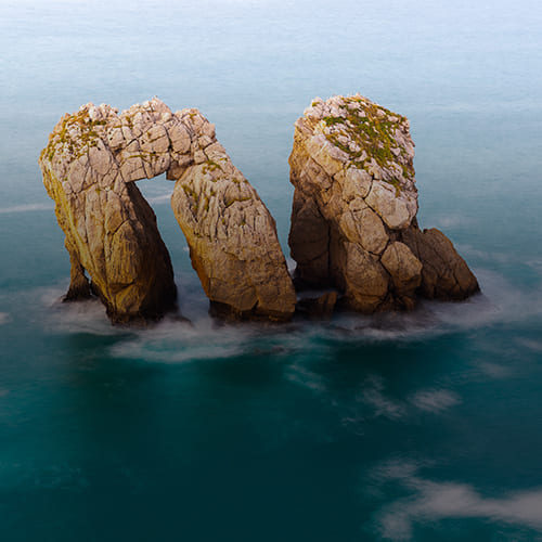
The park is not only a scenically very attractive coastal stretch but also displays a unique collection of coastal landforms and features that provide an opportunity to witness geology in action and discover the origin and evolution of our Earth in a direct and simple way. Visitors can understand this geological history thanks to outstanding examples found along the coastal path. The simple observation of these eloquent features inspires the same ideas and conclusions reached by the first geologists, even for an audience unfamiliar with Earth Sciences. Geology here is, without a doubt, for everyone.
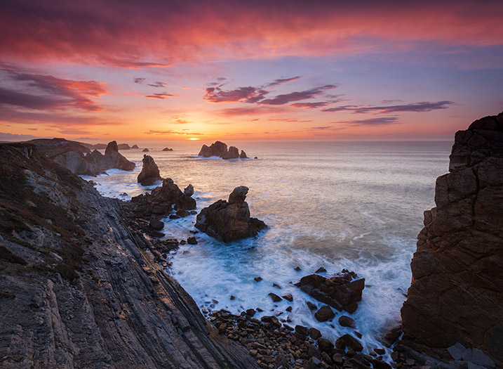
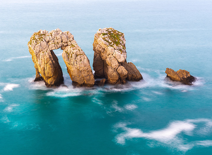
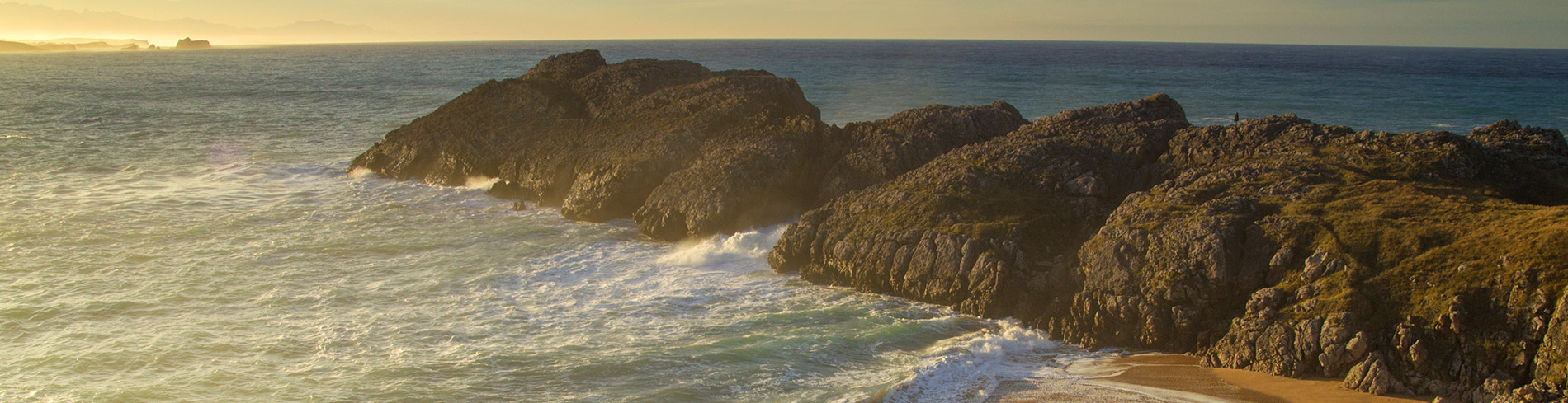
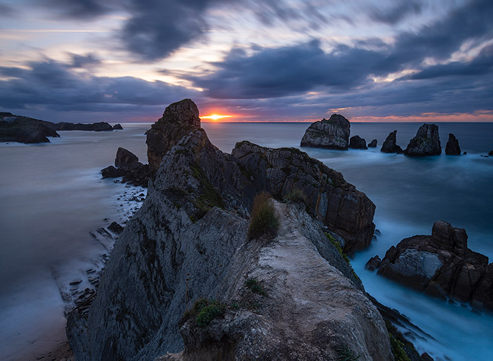
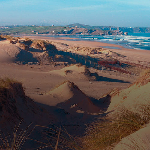
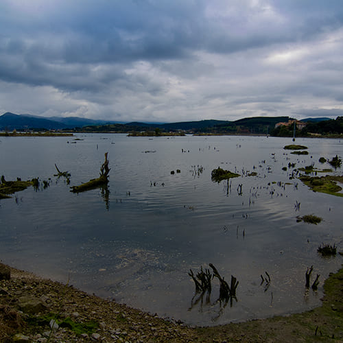
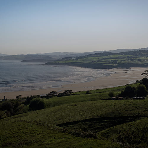
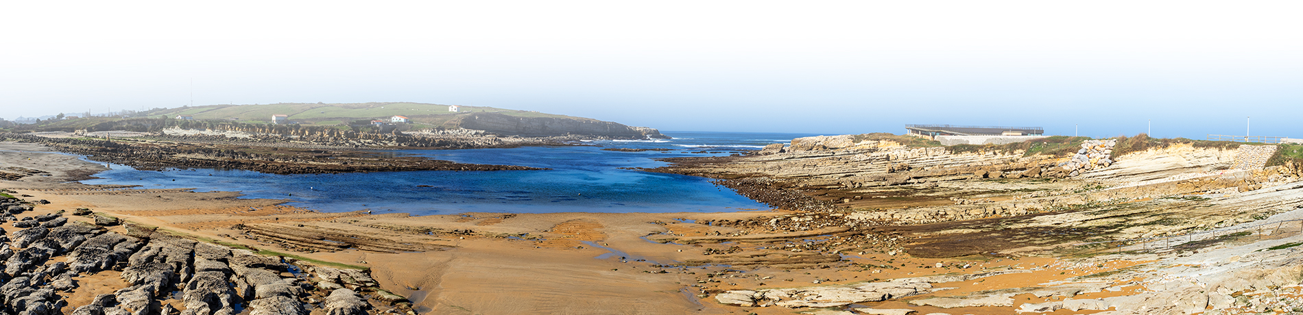
The incessant confrontation between the inclined rock layers and marine action has produced a very diverse set of structures and forms that extend along about 20 kilometers of coastline: cliffs, arches, islets, coves, beaches, tombolos, dunes, spits, and estuaries showcase the constant and relentless evolution of coastal areas. A closer look at the rock outcrops reveals the remnants of ancient tropical reefs, enormous beaches and forests, marine ecosystems frozen in time, and the events that annihilated them. Furthermore, the park demonstrates the close relationship between humans and geological heritage throughout history.
Normally, Costa Quebrada is associated with the first line of the coast, but the territory that forms part of the Costa Quebrada Geopark is also found in inland areas. A good example is the El Pendo cave, the unparalleled jewel: the Altamira Cave, the Tremeo well… An extensive network distributed over a vast area to experience not only a geological adventure but also gastronomic, cultural, traditional, natural, faunal, and sporting enjoyment.
The Costa Quebrada Geopark offers the following activities throughout the year:
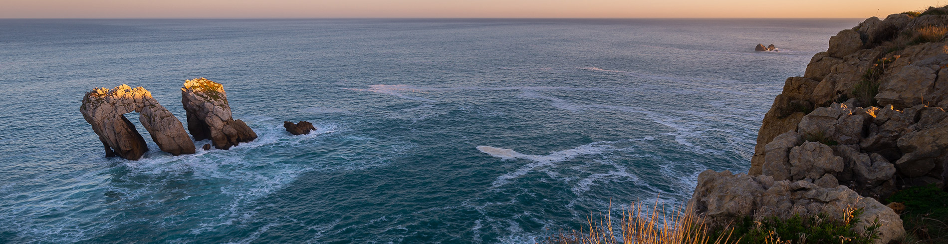
Visiting the Geopark outside the summer season is a fantastic option for those who prefer the solitude of the coast and more intimate experiences. These are the seasons for landscape photography enthusiasts. At that time, the dramatic lights and weather, when combined with the superb landscape, provide countless photographic opportunities for the aesthetic traveler.
Enjoy towering cliffs dotted with golden beaches and geological points of interest, and get in touch with marine life and the diversity of local botany in the Costa Quebrada Geopark.